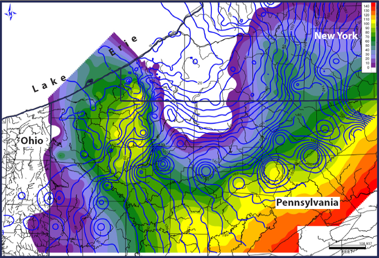
Isopachs are contour lines which represent equal thickness, displaying on a map sediment thickness stratigraphically rather than true vetical thickness. This isopach map depicts the thickness in feet of Tully Limestone with isopachs of the Moscow Shale, the thick blue lines.

No comments:
Post a Comment